Boston / Charles River running routes
Note: These routes all start and end near the Charles/MGH T train stop in Boston’s Beacon Hill neighborhood.
Along with nearby Back Bay, this area around the Charles River is one of the best for an uninterrupted and scenic run. If you find yourself starting in another location around town and need an alternative route recommendation, feel free to email me.
If you’re looking for coffee or a pastry after your run, check out Tatte Bakery on Charles Street in Beacon Hill. After you grab a bite, you can continue your cooldown and walk 15 minutes through the Public Garden to see the Boston Marathon finish line.
Easy loop (~3.4 miles)
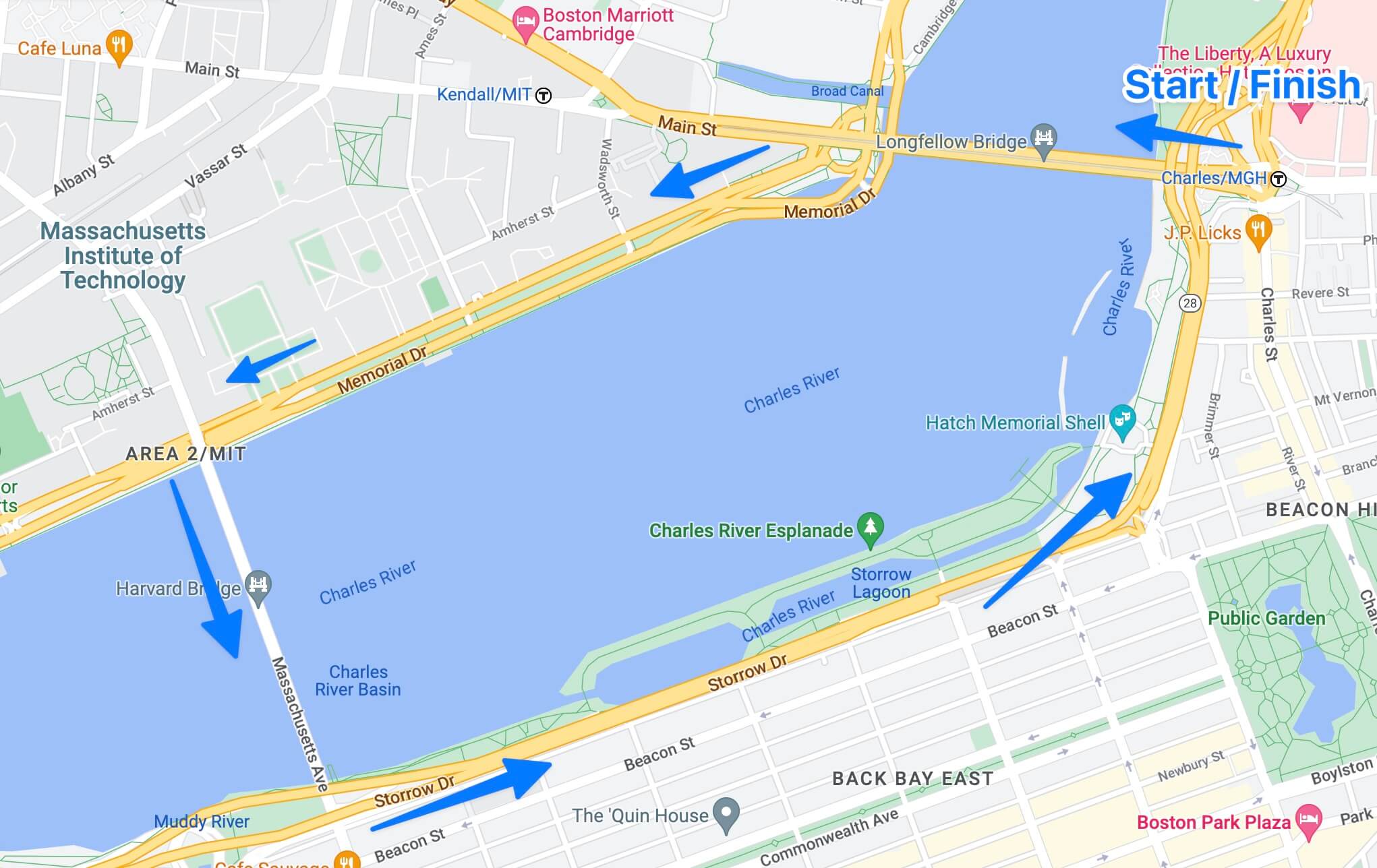
This fast and (mostly) flat loop shows off both the Boston and Cambridge skylines. You can choose to run the Cambridge segment of this loop on either the paved bike path or the dirt path directly next to the river.
Route directions:
Start at the Charles/MGH T Stop (on the Red Line) and run over the Longfellow Bridge (towards Cambridge). Take a left at the bottom of the bridge and run along the river towards MIT. Take a left over the Harvard (“Mass Ave”) Bridge and then head back towards the start along the Esplanade.
5-mile loop
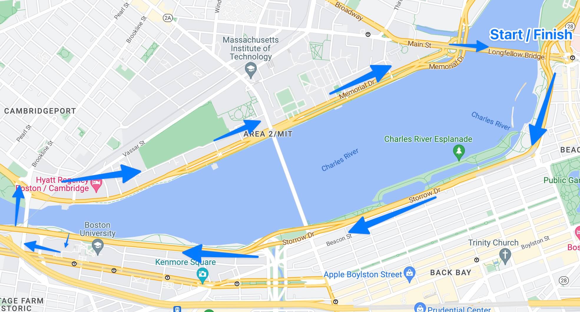
Bridges aside, this is a mostly flat / paved route — ideal for workouts or time trials where you might be marking splits on your watch. This is also a great loop for a bike ride, with public bikeshare (“Blue Bikes”) locations near the start / finish.
Route directions:
Start at the Charles/MGH T Stop (on the Red Line) and run left along the Esplanade towards Back Bay / Fenway. Continue all the way until you see the Boston University Chapel on the left side. Cross over the footpath to the BU side and turn right onto Comm. Ave until you hit the BU Bridge. Go over the bridge and turn right, passing MIT on your left as you run all the way to the Longfellow Bridge. Cross it to complete your loop.
7-24 mile “Long Run” route
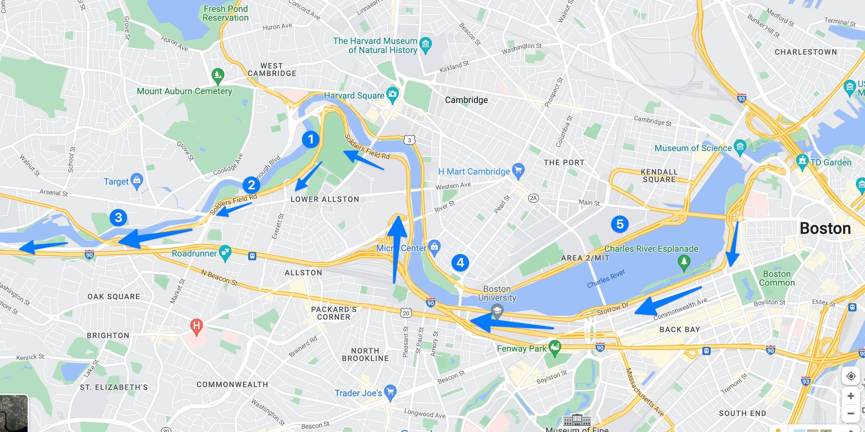
This is a great one for Fall marathon training, as you can follow a bike path filled with water stops + restrooms along the Charles River all the way down to Watertown and beyond (using your turnaround point to control total distance).
Route directions:
Follow the same route described above in the “5-mile loop,” but do not cross over the footpath to BU. Instead, continue along the Charles River trail past Harvard’s campus until you come to Eliot Bridge / the Cambridge Boat Club. To the right of the bridge is a spiraling trail that will take you down onto the Dudley White Bike Path, keeping you alongside the Charles River for up to 24 miles (out and back).
Notable water / bathroom stops along this route (see map above for approximate placement).
Note that these stops / fountains are all open in the spring and summer, but mostly closed in winter months
-
After you loop under the bridge onto the bike path, you’ll find public portable restrooms and a Kayak / Boat rental launch that has a public water cooler in the summer.
-
A bit further down the same path, you’ll find an outdoor beer garden. I’ve never had any issues asking nicely to use the restrooms, though note that they might ask that you buy a bottle of water.
-
Further down the path, you’ll see some recreation fields on the right. Here you’ll find some water fountains and full-featured bathrooms.
-
On your way back, you’ll see a Shell station with a bathroom. This is also a good place to stop and buy a gatorade if you’re in the back half of your long run.
-
There’s a smattering of water fountains along the Cambridge waterfront, but one that has worked consistently in the summers has been along the bike path by the second boathouse (in the direction of Beacon Hill).